Front matter

The Imperial Gazetteer of India, Vol. II, The India Office, 1908 · from page 6 · about 1 minutes

Read by machine, not yet checked by a person. It may hold small errors.

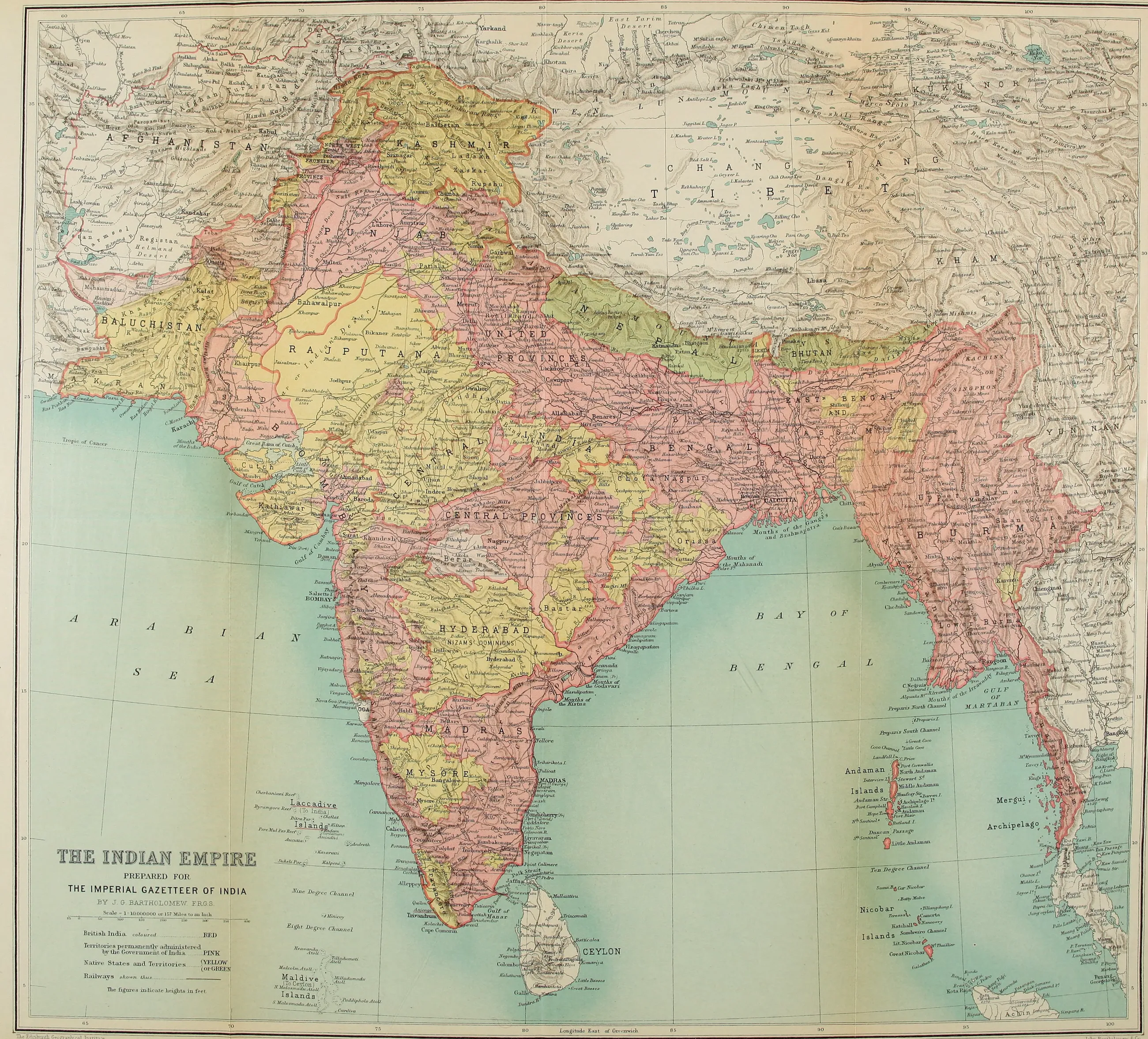
Map of the Indian Empire prepared for the Imperial Gazetteer of India by J. G. Bartholomew, F.R.G.S., Scale 1:10,000,000 or 157 Miles to an Inch, showing British India, territories permanently administered by the Government of India, Native States and Territories, and railways.

The Edinburgh Geographical Institute

John Bartholomew & Co.

THE INDIAN EMPIRE

VOL. II

HISTORICAL

NEW EDITION

PUBLISHED UNDER THE AUTHORITY OF HIS MAJESTY'S SECRETARY OF STATE FOR INDIA IN COUNCIL

OXFORD AT THE CLARENDON PRESS 1908

HENRY FROWDE, M.A. PUBLISHER TO THE UNIVERSITY OF OXFORD LONDON, EDINBURGH NEW YORK AND TORONTO